New navigation solution promises reliable positioning for drones, even without GPS

Australian company Advanced Navigation and MBDA UK have teamed up to develop a robust navigation system designed to provide accurate absolute positioning for a variety of airborne platforms, even in the absence of GPS signals.
The resulting technology will enable drones and other systems to establish absolute positioning without requiring external signals, making it immune to interference. The innovative system, which draws inspiration from biological processes, utilises patent-pending technology from Nileq, a subsidiary of MBDA UK, based in Bristol.
Interference is becoming commonplace
The companies aim to meet the growing demand for resilient, reliable positioning in multiple sectors, including the agricultural drone market. Chris Shaw, CEO of Advanced Navigation, emphasises that interference is becoming commonplace. “Commercial and military sectors can no longer rely solely on GNSS for flight operations.” The system also aligns with expanding legal mandates requiring alternatives to GPS-based solutions.
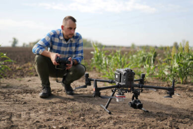
When mounted on a platform, for example an agricultural drone, the system uses a camera to capture and analyse the environment below, identifying landmarks and features. These images are then compared with a pre-existing Earth surface database through a technique called map matching, allowing the system to determine its precise location. This process significantly enhances inertial navigation by providing frequent position updates and recalibrating the system’s location.

Immune to interference
Conventional navigation systems typically rely on high-resolution cameras that generate massive datasets, which must be compared with satellite images using computationally intense methods. This poses a challenge for small, power-limited devices like drones, which often cannot support such resource-heavy computations.
To address this, Nileq’s system incorporates a neuromorphic camera, designed to mimic the human retina. This camera generates significantly less data and operates much faster than traditional cameras, which capture images sequentially. By reducing both data volume and processing demands, the system provides an efficient solution for GPS-free navigation in various environments.
The resulting technology will enable drones and other systems to establish absolute positioning without requiring external signals, making it immune to interference. The innovation is particularly beneficial for operations beyond visual line of sight, improving the safety and performance of such missions while overcoming the limitations of traditional image-based navigation systems.
Geo-referencing crop hazards
Advanced Navigation is already active in the agricultural sector, providing navigation solutions for companies designing autonomous farm robots or converting traditional machines to autonomous ones. “The benefits of autonomous systems in agriculture are numerous”, says Advanced Navigation.
“In addition to reducing labour costs, these systems can help detect and geo-reference crop hazards, such as weeds and pests. This enables farmers to apply pesticides or herbicides more precisely, reducing chemical usage and promoting healthier soil. These advantages result in significant savings in time and costs, as well as improved crop quality and yield.”
Join 17,000+ subscribers
Subscribe to our newsletter to stay updated about all the need-to-know content in the agricultural sector, two times a week.


