How archaeology can improve crop input decisions

Archaeology could have a role in helping to explain some of the in-field variations detected by drones and satellites, thereby helping farmers make better crop input decisions.
Archaeology and farming
- Both professions generate soil data
- Archaeology can affect cropping
- Help explain yield and nutrient variation in some fields
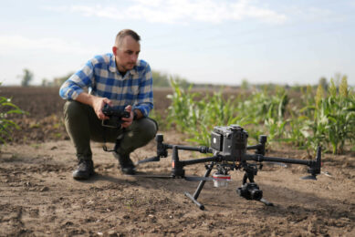
Farmers are increasingly using drones to map differences in crop growth for fertiliser management, often combining yield data to identify poor performing areas of the field.
His family have a mixed farm in Essex, and he has previously worked for the Intelligent Precision Farming Company (IPF), which meant he was already familiar with the precision mapping technologies being used to manage crops. |
Similarities between archaeology and zoning soils
And while studying for a degree in archaeology at the University of Bristol, he started to see the similarities – with archaeologists using geophysics to map underground features and farmers zoning soils in their fields.
Soil phosphorus levels
Phosphorous, and other geochemical mapping, helps archaeologists build a picture of how the land has been used over the centuries, he explains.
“Manure tended to be applied to fields closer to the farmstead, so you see halos around existing farms, or those that are no longer there and are now buried under the surface, where soils are more P rich. These types of effects can be seen from the Iron Age right through the medieval period until modern day.”
“It is also not only manure that can alter the soil, at sites where small scale processing or manufacturing took place it is possible to find enhancements of certain nutrients and heavy metals.”
So could farmers benefit from using archaeological data?
To answer this, he embarked on a 3-year PhD, with the Universities of Bristol and Reading, with support from Historic England.
See also: Online mapping tool makes it easier to zone fields
His aim was to examine different case studies and gather evidence of how archaeology impacts cropping and what it means for precision farming. And more importantly, could this information help farmers.
Research sites varied from WWII to Roman villas
Archaeological sites varied widely from World War II airfield remains, to Roman villas, to a much older Neolithic henge.
He found that there was an impact on cropping and it could explain some of the variation being seen in normalised difference vegetation index (NDVI) maps generated by drones and satellites.
High P levels in soil at Iron Age site
With one Iron Age settlement, P levels in the top soil were double that to the rest of the field. “With other sites, you can see high zinc and arsenic levels,” he says.
In Dorset, a biomass map of an oilseed rape crop picked up several round features and these were caused by a set of Iron Age pits where the soil was much deeper, full of phosphorus and organic matter.
Similarly, the man-made ditches around a Neolithic henge led to higher crop biomass, as this had been filled in over the years with organic material resulting in a rich, 1.2m deep soil that crops thrived in.
Knowing the archaeology on your farms
Armed with this information, the farmer could better plan their nutrient inputs, avoiding over-applying phosphates or nitrogen fertilisers in these areas, he says.
His conclusion is that farmers need to be more aware of the archaeology on their farm and how they might be able to harness this information.
It could be an extra layer of data as part of precision farming software.
Archaeologist can help interpret data
Archaeologists can also benefit, as sometimes drone maps can reveal features that were previously unknown, and in this new approach, having archaeologists help interpret the data, could help farmers too.
To put this into context, he took a random sample areas of the UK and, with existing archaeological datasets, estimated that some 60-70% of fields had archaeological features within them.
However, he adds, this was only a sample of known sites and if you add in the likelihood of features that have never been mapped, this figure will be higher with most farms seeing an impact from archaeology.
Mr Webber is now looking to secure funding, and willing farmers, to scale up his work.
“I want to look more at the whole farm, rather than sampling at the field level and see how this data can be used for both precision farming companies, and farmers themselves.”
Join 17,000+ subscribers
Subscribe to our newsletter to stay updated about all the need-to-know content in the agricultural sector, two times a week.
 Sometimes there are variations that cannot be explained in terms of agronomy or soil type. Henry Webber believes the answer may lie under the soil surface.


