Tractors scrambled on the eastern border of Finland by Russian interference

Farming on the eastern border of Finland is in trouble because the tractors do not get the correct location information from the GPS. The interference is apparently coming from Russia.
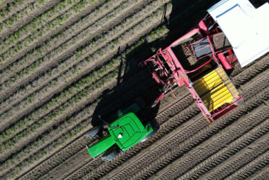
Finnish national public broadcasting company Yle mentions that farmers on the eastern border of Finland have a problem, because tractors and other agricultural machines no longer move in the field as they should. The reason is that someone is interfering with the gps satellite positioning system in the area. The harassment is apparently coming from across the border from Russia.
Kari Pekonen, who cultivates his fields in Parikkala, about ten kilometers from the state border between Finland and Russia, is upset about the problem.
Reported problems
Antti Arminen, executive director of the South-Eastern Finland Federation of the Confederation of Agricultural and Forestry Producers MTK, says that complaints about satellite positioning problems have come from different parts of South Karelia. Several farmers have reported problems in, for example, Lappeenranta, which is located about a hundred kilometers south of Parikkala.
There have been big problems with satellite positioning this spring, Antti Arminen emphasizes. Arminen has encountered difficulties with satellite positioning in Lappeenranta also on his own farm, which is located about ten kilometers from the eastern border. The tractor’s driving line, which should stay within about ten centimeters, can throw up to two meters in places, Arminen describes.
The problems started with the Russian invasion
According to Kari Pekonen, the problems with GPS satellite positioning started in the summer of 2022 after Russia had invaded Ukraine. In the current year, the problems have increased even more. This can also be seen on the interference maps of the gpsjam.org web service that tracks GPS interference.
Due to the problems of free GPS satellite positioning on the eastern border, and partly deeper in the country, farmers have to resort to substitute paid systems for controlling agricultural machines in the field. This is, for example, RTK positioning, which uses terrestrial base stations in addition to satellites to determine the location. It has worked well here, says Kari Pekonen.
Join 17,000+ subscribers
Subscribe to our newsletter to stay updated about all the need-to-know content in the agricultural sector, two times a week.